Garmin Mobile(TM) Navigates BlackBerry-® Customers Door-to-Door
OLATHE, Kan., Sept. 12 / -- Garmin International Inc., a unit of Garmin Ltd. (NASDAQ:GRMN), today announced that Garmin Mobile -- an application that delivers maps, directions, and turn-by-turn navigation -- will be available on select BlackBerry devices. The availability of Garmin Mobile on BlackBerry devices gives BlackBerry customers numerous features that they would not normally have access...
Read More »Software/Service provides automated video geotagging.
PocketCaster mobile software can automatically embed handset's position in each frame of video, creating dynamic stream of geotagging. Viewers can watch PocketCaster-created video live or on-demand, and can concurrently see location represented as dot or moving direction path on satellite map. Tapping into Waypoint Database System, waypoint tags can be set for locations or landmarks, then all...
Read More »GPS Device incorporates 4.3 in. touchscreen.
The nuvi 660 GPS navigator enables motorists to obtain voice-prompted turn-by-turn directions, route calculations, and automatic rerouting if they stray off course, while integrated traffic receiver makes it possible to avoid traffic and road construction delays. FM transmitter broadcasts voice guidance, MP3, audio books, and phone calls over vehicle's speakers. Bluetooth capabilities along with...
Read More »Trimble Launches AllSport GPS for its Trimble Outdoors Product Line
Trimble Outdoors Adds Extensive Fitness Training and Performance Management Applications to its GPS-on-Cellular Service Offerings SUNNYVALE, Calif., Aug. 28 // -- Trimble (NASDAQ:TRMB) introduced today its new AllSport GPS application to extend its Trimble Outdoors(TM) family of products and services into the personal fitness management category. The fitness training application supports a range...
Read More »
Super Precision Bearings for Machine Tools: Factors For A Successful Spindle Bearing Set Up
This white paper provides an in-depth overview into choosing the right bearing for machine tools.
Read More »Crystal Oscillator facilitates tracking of GPS signals.
Packaged as standard 5 x 3.2 mm SMD, Model CFPT-127 TCXO offers frequency stability of Ã-
Read More »Navigation Devices suit business travelers and commuters.
Bluetooth-enabled DigiWalker(TM) C710 portable navigation device offers real-time traffic updates and links to peripherals, computers, or cell phones. Featuring media player and 2GB of flash ROM, device provides access to 5 mil points of interest and comes preloaded with maps of US and Canada. DigiWalker(TM) C210s includes touch screen interface for control without need for stylus and features...
Read More »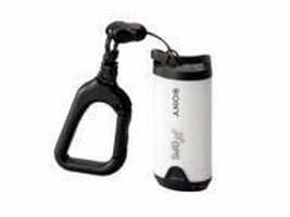
GPS Device plots digital images to map.
Adding geographic context to digital images, Model GPS-CS1 12-channel GPS unit enables photographers to pinpoint exactly where they've been. Users can arrange pictures geographically by importing logged data from GPS device by downloading digital images to computer. GPS Image Tracker software synchronizes images on camera with latitude, longitude, and time readings from GPS-CS1. Unit weighs 2 oz,...
Read More »GPS Surveying System is designed for single-person operation.
Model GPS900 RTK surveying system is complete base and rover system providing centimeter-level accuracy, 2 Hz position update rate, and range of 1.5 miles from base station. Functions are controlled through graphic display using touch screen or keypad, and measurements and codes stored in internal memory can be exported to any GPS survey system. Unit meets MIL-STD-810F standards for temperature,...
Read More »GPS Monitoring System helps ensure offender compliance.
Using tamper-resistant components, iSECUREtrac System 5000(TM) is based on integrated GPS offender monitoring device, which is electronically tethered to IntelliCuff(TM) intelligent locking ankle bracelet. If offender nears range limit of monitoring device, IntelliCuff triggers vibrating alarm, ensuring wearer will not accidentally leave monitoring device at home. System 5000 supports multiple...
Read More »Portable Aviation Device facilitates navigation for pilots.
Full-color GPSMAP 496 incorporates SafeTaxi(TM) airport diagrams, Smart Airspace(TM), AOPA's Airport Directory data, high-resolution terrain database, aviation database with private airports and heliports, as well as pre-loaded automotive maps of North America or Europe and optional XM WX Satellite Weather(TM). On road, unit serves as in-car navigation system with automatic route calculation to...
Read More »
Oilfield Improvements® Wheeled Rod Guide® Couplings Celebrate 35th Anniversary
For over 35 years our Wheeled Rod Guide Couplings, have been at work in oil fields across the globe. Our products are engineered to extend the service life of sucker rods and tubing, delivering cutting-edge innovation that enhances oilfield operation, maximizes output, and enhancing overall operations. To learn about the advantages of using Wheeled Rod Guide Couplings in your wells, see our video.
Read More »