TechAdvantage 2013: 3-GIS Goes Live in New Orleans
3-GIS Live gives clients elastic, secure, reliable cloud delivery model through Amazon EC2 NEW ORLEANS - While New Orleans may be winding down from Mardi Gras, the city is just about to get started with the TechAdvantage Conference Expo 2013. 3-GIS, a global leading GIS software solutions company headquartered in Decatur, Alabama will be exhibiting at the event and previewing 3-GIS Live, its new...
Read More »3-GIS' Newest Solution Provides a Powerful Tool for Incident Management After Latest Storms, Power Outages
DECATUR, Alabama - While municipalities and utility companies across large areas of the Midwestern and Northeastern United States work to restore utility service to their customers, 3-GIS, a global leading GIS software solutions company,Ã- highlighted its release of a powerful tool for the utility industry that could help dramatically, and efficiently, speed up that restoration of service....
Read More »Elsevier and the Society of Economic Geologists (SEG) Deliver Specialized Content to Exploration Geologists
NEW YORK - Over a century's worth of geological maps from SEG are now discoverable and downloadable through Geofacets Elsevier [www.elsevier.com], a world-leading provider of scientific, medical and technical information products and services, and the Society of Economic Geologists [www.segweb.org] (SEG) today announced the inclusion of maps from SEG's flagship Economic Geology journal into...
Read More »deCarta MapSearch Hits 1 Million Unique Mobile Users in First 2 Weeks
deCarta provides maps, local search, and directions for Opera Mini users in 14 countries SAN JOSE, Calif. - deCarta's MapSearch mobile application, which provides integrated maps, local search, and directions across a wide variety of handset platforms and countries, has hit the one million user milestone in less than two weeks after its launch on March 22. deCarta MapSearch offers a white label...
Read More »Data driven digital platforms for automotive transformation
Two key initiatives in this transformation are smart manufacturing/Industry 4.0 and the emphasis on increased collaboration between stakeholders.
Read More »NAVTEQ-® Maps Now Power Panasonic's New Digital Cameras
NAVTEQ location content enables geotagging of photos and images CHICAGO- NAVTEQ, the leading global provider of maps, traffic and location data enabling navigation, location-based services and mobile advertising around the world is supplying NAVTEQÃ-® map and location content for Panasonic's LUMIX DMC-TZ20/ZS10 and DMC-FT3/TS3, the newest member of Panasonic's acclaimed LUMIX Series of...
Read More »Mapping Data helps users navigate interior spaces.
NAVTEQ Destination Maps(TM) enables orientation, guidance, and routing for interior spaces. Product moves beyond interactive floor plan maps into 3D data model by providing pedestrian-specific attributes unique to interior requirements, such as stairs and elevators, as well as recognizing different floor levels. Destination Maps also includes access restrictions to avoid being guided to emergency...
Read More »Utility, Inc. Signs Distribution Deal with Promark Technology
Major Distributor to Offer Company's Comprehensive Mobile Resource Management Solution ATLANTA - Utility, Inc., a provider of technology and services that allow first responders and utilities to more effectively command, control and support mobile field operations, and Promark Technology, Inc., a premier value-added distributor of data storage products and solutions, have signed a distribution...
Read More »Cities Get Smarter with IBM's Location-based Analytics
IBM unveils smarter cities wins in Wilmington, North Carolina; Waterloo, Ontario, Canada; and Washington D.C. LAS VEGAS -- IBM (NYSE: IBM) today announced that it is working with cities around the world to help them gain new efficiencies by visualizing and analyzing their physical and digital assets in real-time. IBM is announcing Smarter Cities projects in Wilmington, N.C., Waterloo, Ontario,...
Read More »NAVTEQ Chosen to Provide Location Content for 100% Electric Nissan LEAF
Points of Interest (POIs) specifically developed to guide and inform Electric Vehicle (EV) drivers GENEVA -- NAVTEQ, the leading global provider of maps, traffic and location data enabling navigation, location-based services and mobile advertising around the world is supplying Nissan with a specialized dataset which provides relevant location information, such as location of charging stations, to...
Read More »
Ruggedized GNSS/GIS Handhelds automate dataflow.
Leica Zeno GIS series integrates EasyIn to promote dataflow between field and office by simultaneously checking in features and GNSS raw data, automatically post-processing GNSS observations, and updating feature vertices to most accurate location. While Leica Zeno 10 provides color graphic display in portrait format and numeric keypad, Leica Zeno 15 offers full QWERTY keyboard and display in...
Read More »
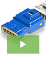
560 and 572 Series IP67 Waterproof Inline Plug and Socket Connectors with Shock and Vibration Resistance
EDAC's new line of IP67 waterproof plug and socket connectors represent the cutting edge of waterproof connection technology. Part of the 560 and 572 series of connectors, they utilize innovative design concepts to deliver a level of performance and value that is unmatched in the industry. See our video to learn more.
Read More »


