Seabed Mapping Suite supports Synthetic Aperture Sonar processing.
Press Release Summary:
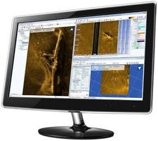
DELPH v3.1 comprises DELPH SAS, Seismic, Sonar, and Magnetic components as built on modular, common architecture with acquisition, processing, and interpretation layers. Optimized workflow allows full integration of SAS data together with side-scan sonar, bathymetry, sub-bottom profiling, magnetic, and other information layers. Also, features such as batch data processing and mosaicking, target picking and management, interpretation, and seabed classification are available for SAS imagery.
Original Press Release:
iXBlue Expands DELPH 3.1 Seabed Mapping Software Suite, Adding DELPH SAS (Synthetic Aperture Sonar processing) Module
MARLY-LE-ROI, France – iXBlue, a global leader in navigation, positioning and imaging solutions, has released the new synthetic aperture sonar (SAS) processing software module, a new addition to iXBlue's proven DELPH 3.1 seabed mapping software suite. DELPH SAS leverages company's extensive experience in sonar signal processing and associated seabed mapping solution software. DELPH 3.1 software suite now comprises of DELPH SAS, Seismic, Sonar, and Magnetic components, built on a modular common architecture with acquisition, processing, and interpretation layers.
Today All SAS sonars require dedicated processing software to deal with the amount of collected data and its format. However, what exists today hardly meets the requirements of the survey industry to standardise the processing and interpretation tasks for geophysical data. This is why iXBlue developed DELPH SAS, the addition of this new module is key as it fully integrates Synthetic Aperture Sonar imaging into an industry proven seabed processing software suite.
DELPH is an industry leading software suite providing the best productivity in a user-friendly environment thanks to a highly optimized workflow. Appreciated by major survey companies it now allows the full integration of SAS data together with conventional side-scan sonar, bathymetry, sub-bottom profiling, magnetic and other information layers. In addition, all existing features available in DELPH Sonar Interpretation like batch data processing and mosaicking, target picking and management, interpretation and seabed classification are now also available for SAS imagery.
DELPH SAS processing goes further than regular processing as it tightly couples sonar and positioning data, thus naturally producing accurately geo-referenced images, with a very robust algorithm not sensible to vehicle movements. Several benefits come to play in improving data interpretation like the near perfect line matching and the minimal positioning ambiguity which helps in targeting accuracy.
Many advantages come with this new module. Firstly, multi-ping integration in SAS processing results in superior image quality, resolution and range. Secondly, DELPH SAS can also integrate co-registered gap-filler images of the seabed at nadir allowing full-swath sonar coverage. Additionally, the need for overlapping survey lines is reduced therefore further optimisation in survey planning is possible and duplicate data management is limited, thus saving time and money. Finally, as data processing and mosaicking are faster than real-time, online data interpretation is even made possible.
DELPH SAS software complements iXBlue's offer in scalable SAS tow-fish and AUV solutions for the commercial and scientific survey needs. DELPH SAS runs on any standard computer and is compatible with any SAS that delivers raw data.
CONTACT:
Tel: +33-1-30-08-80-57
eva.marie@ixblue.com
www.ixblue.com