Magellan Recognized as TU-Automotive Awards 2016 Finalist
Magellan Named in the Best Aftermarket Telematics Product/Service Category for Its eXplorist TRX7 Off-Road Navigator SANTA CLARA, Calif. - Magellan today announced that it has been named a TU-Automotive Awards 2016 finalist for its eXplorist TRX7 off-road navigator. These awards recognize the leaders pushing the connected car industry forward through innovation, industry engagement and quality...
Read More »Inertial Navigation System supports unmanned applications.
Built on common tactical grade proprietary MEMS inertial sensing core and navigation algorithms, Tactical Series includes VN-110 Inertial Measurement Unit and Attitude Heading Reference System, VN-210 GPS-Aided INS, and VN-310 Dual Antenna GPS/INS. System's 3-axis gyro with
Read More »The ClearPoint-® Neuro Navigation System Featured at AANS Practical Clinics for Third Consecutive Year
Surgeons to have unique opportunity for hands-on training with ClearPoint IRVINE, Calif. –Ã- MRI Interventions, Inc. (OTCQB:MRIC) today announced that its ClearPoint Neuro Navigation System will be utilized in two Practical Clinics at the Annual Meeting of the American Association of Neurological Surgeons (AANS) taking place on April 30 through May 4, 2016, in Chicago, Illinois. Both the...
Read More »Northrop Grumman Navigation System Integral to First Flight of nEUROn Unmanned Combat Aerial Vehicle Demonstrator
FREIBURG, Germany - Northrop Grumman Corporation (NYSE: NOC), in cooperation with Saab Aerosystems, has provided the attitude and heading reference system (AHRS) for the nEUROn Unmanned Combat Aerial Vehicle (UCAV) demonstrator, which recently completed a successful first flight. Northrop Grumman's German navigation systems subsidiary, Northrop Grumman LITEF, supplied the fibre-optic,...
Read More »
Super Precision Bearings for Machine Tools: Factors For A Successful Spindle Bearing Set Up
This white paper provides an in-depth overview into choosing the right bearing for machine tools.
Read More »Navionics Announces Navionics+ and Navionics Updates
Cartography Leader’s Revolutionary New Products Ensure Latest Charts With Freshest Data Wareham, Mass. – Navionics, the leader in electronic charting for the recreational boating market, announced today its new electronic chart standard, Navionics+, and a convenient, reduced cost upgrade for existing charts, Navionics Updates. Providing access to its innovative Freshest Data, Navionics' new...
Read More »
Jeppesen and Navico Announce Compatible Mapping Products
C-MAP by Jeppesen Cartography Available on Lowrance, Simrad Yachting and B&G Chartplotters and Multifunction Displays ENGLEWOOD, Colo. - World navigation expert, Jeppesen, and Navico--the world leader in recreational marine electronics and parent company to the Lowrance, Simrad Yachting and B&G brands--have teamed up to provide consumers with a new charting option. C-MAP MAX-N now provides...
Read More »NAVTEQ-® Maps Now Power Panasonic's New Digital Cameras
NAVTEQ location content enables geotagging of photos and images CHICAGO- NAVTEQ, the leading global provider of maps, traffic and location data enabling navigation, location-based services and mobile advertising around the world is supplying NAVTEQÃ-® map and location content for Panasonic's LUMIX DMC-TZ20/ZS10 and DMC-FT3/TS3, the newest member of Panasonic's acclaimed LUMIX Series of...
Read More »Mapping Data helps users navigate interior spaces.
NAVTEQ Destination Maps(TM) enables orientation, guidance, and routing for interior spaces. Product moves beyond interactive floor plan maps into 3D data model by providing pedestrian-specific attributes unique to interior requirements, such as stairs and elevators, as well as recognizing different floor levels. Destination Maps also includes access restrictions to avoid being guided to emergency...
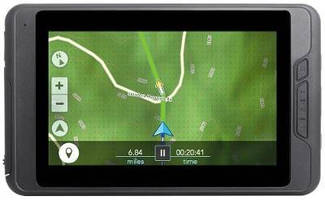
Read More »Five Inch Navigation Unit meets needs of professional drivers.
Along with bright light visibility, 5550 PRO offers interface that aids interaction when scrolling through searches and configuration settings. Quick-Tabs feature makes critical information readily available to driver, and Junction View with Lane Assist provides 3D images of upcoming highway junctions as well as lane guidance and turn-by-turn directions. Also, map is optimized for miles of road...
Read More »In-Vehicle Computer tracks hours of truck service.
Equipped with 1.6 GHz processor and solid-state hard drive, TruckPC Mobile Communication System tracks and manages driver's hours of service, enabling companies to meet CSA requirements. Unit includes 2-way communication, fully integrated navigation, and driver behavior monitoring, which warns drivers of sharp curves, steep hills, speed limit changes, and road construction. FleetWatcher back-end...
Read More »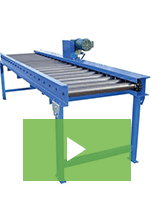
Increase Workplace Safety, Manage Heavy Loads with Equipment from A-Plus Warehouse
A-Plus Warehouse carries a wide selection of commercial and industrial material handling equipment at affordable prices. Check out the video to learn more.
Read More »