Airborne Laser Scanner offers 200 kHz at-the-ground pulse rate.
Share:
Press Release Summary:
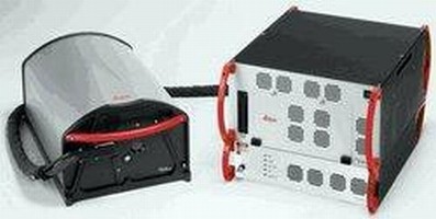
Reconfigurable for inside or pod mounting, Leica ALS60 airborne laser scanner has flying height envelope ranging from helicopter-compatible 200 m AGL to 5,000 m AGL for wide-area mapping. Unit allows accurate data collection independent of pulse rate, depending only on flying height. Based on MPiA technology, scanner is suited for LIDAR jobs varying from city mapping applications requiring high point densities to large-area contracts with low point densities.
Original Press Release:
Leica ALS60 Is Redefining the Power of LIDAR Mapping, Now with 200 kHz "At-the-Ground" Pulse Rate, Industry Best Productivity and Improved Reliability
Norcross, GA - July 10, 2008 - The new Leica ALS60 Airborne Laser Scanner builds on the legacy of productivity, accuracy and flexibility that have made Leica Geosystems' ALS series instruments the fastest selling airborne LIDAR systems in the industry. Continued technical advancements result in a new generation of LIDAR systems that are more productive than ever before.
Leica ALS60 flexibility: Quickly reconfigurable for inside or pod mounting, thanks to the low-profile Leica LS60 scanner LIDAR jobs come in all sizes, from city mapping applications requiring ultra-high point densities to large-area contracts with lower point densities best served from greater flying heights. Leica ALS60's MPiA technology increases the productivity by 100%
Leica Geosystems' third-generation LIDAR system, the Leica ALS60, continues to break traditional paradigms such as having to choose between rapidly-acquired, high-density data and achieving outstanding accuracy - or having to choose between a compact system and one with high-altitude performance. The Leica ALS60 allows accurate data collection independent of pulse rate, depending instead only on flying height. In addition, its flying height envelope ranges from a helicopter-compatible 200 m AGL to 5000 m AGL for wide-area mapping.
Leica ALS60 delivers accurate data faster
"LIDAR jobs come in all sizes, from city mapping applications requiring ultra-high point densities to large-area contracts with lower point densities best served from greater flying heights. Leica ALS60's MPiA technology increases the productivity by 100%," says George Southard, Leica Geosystems' Vice President Americas' Digital Imaging.
Leica Geosystems - when it has to be right
With close to 200 years of pioneering solutions to measure the world, Leica Geosystems products and services are trusted by professionals worldwide to help them capture, analyze, and present spatial information. Leica Geosystems is best known for its broad array of products that capture accurately, model quickly, analyze easily, and visualize and present spatial information.
Those who use Leica Geosystems products every day trust them for their dependability, the value they deliver, and the superior customer support. Based in Heerbrugg, Switzerland, Leica Geosystems is a global company with tens of thousands of customers supported by more than 3'500 employees in 28 countries and hundreds of partners located in more than 120 countries around the world. Leica Geosystems is part of the Hexagon Group, Sweden.